Germantown Hills Trail Study Gathers Public Feedback
Tri-County helped fund a trail exploration project to connect Germantown Hills with other regional destinations
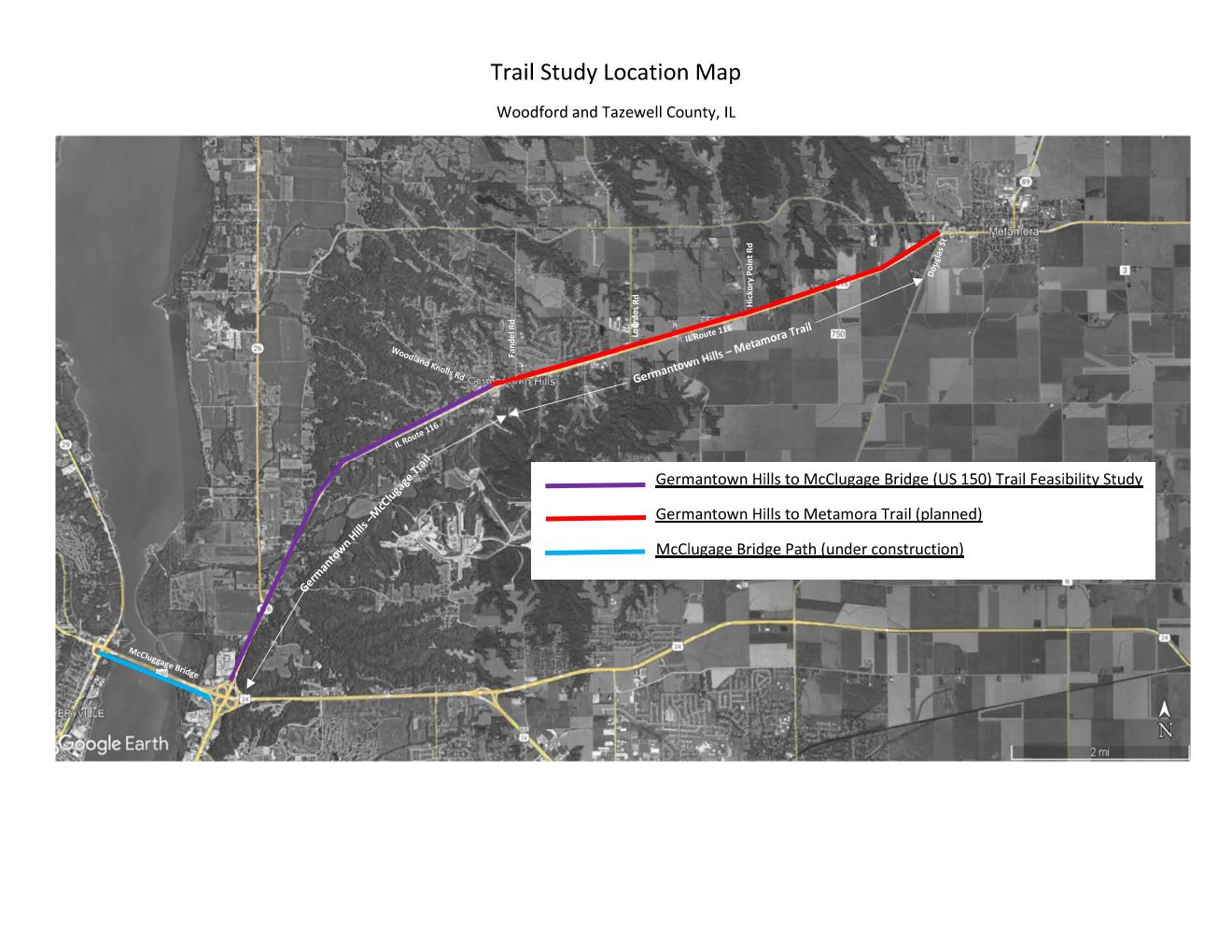
Through a grant with Tri-County Regional Planning Commission, the Village of Germantown Hills has partnered with engineering and planning firm Crawford, Murphy & Tilly to conduct a trail feasibility study. The scope of the project lies within an approximately five-mile-long corridor along IL-116 between the McClugage Bridge (US 150) and Woodland Knolls Drive in Germantown Hills. The IL-116 corridor is being evaluated as a potential location for a trail, with challenges and benefits being identified.
The project planning group is identifying preliminary alternative trail configurations along IL-116. The goal of this study is to become aware of challenges that may exist within this corridor to accommodate a trail and ultimately determine whether it is feasible to construct a trail.
Multiple alignments for a trail to navigate through key intersections, including the IL-116 and IL-26 intersection and IL-116 and US-24/US-150 interchange, are being evaluated to identify preferred alternatives focused on crossing safety. This proposed trail would help broaden the regional trail network by connecting the Rock Island Greenway, new McClugage Bridge bike path, and future Germantown Hills to Metamora trail.
Engagement with stakeholders, including the Bike Peoria bicyclists’ group, is occurring in early November. IDOT has also been consulted to identify early preferences and challenges. A public feedback form on the study is open until November 20.
The feasibility study is anticipated to be completed by the end of 2024. Currently, no funding or timeline for engineering or construction has been identified; that will be a future initiative to continue this process.